


For Tropical North Atlantic Ocean, Caribbean Sea and Gulf of Mexico
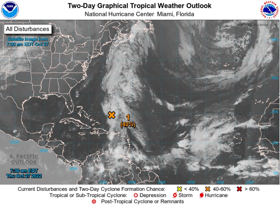
AREA OF SPECIAL INTEREST: 10 – 20 °N AND 45 – 65 °W
Tropical wave #1: A Caribbean tropical wave has its axis along 67°W from 09°N to 19°N, moving W at 5-10 kt. The wave is interacting with a deep-layered trough along 69°W-70°W, resulting in scattered to locally numerous moderate to strong convection from 10N to 14.5N between 62°W and 67.5°W, and from 16°N northward across Puerto Rico and into the adjacent Atlantic between 66°W and 68°W. This wave together with an upper and low-lever trough continues to modulate the ITCZ, which will continue to bring showers and thundershowers to Grenada today and tomorrow. A minor flood and small-scale slides warning is in effect.
Tropical wave #2: A tropical wave has its axis along 44°W-45°W from 05°N to 15°N moving W near 15 kt. The wave is tilted NNE to SSW. Scattered moderate to strong convection is occurring across northern portions of the wave, from 11°N-16°N between 41°W and 46°W. Night scatterometer data showed moderate to locally fresh NE to E winds are on either side of the wave axis between 12°N and 17°N.
Low Pressure area: An area of low pressure is expected to form over the eastern Caribbean Sea this weekend, possibly related to the southern portion of an existing trough of low pressure over the area. Thereafter, environmental conditions are forecast to be conducive for gradual development, and a tropical depression could form early next week while the disturbance moves generally westward or west northwestward into the central Caribbean Sea.
- Formation chance through 48 hours…low…near 0%.
- Formation chance through 5 days…medium…50%. This system poses no threat to the State of Grenada.
The Meteorological Service will continue to monitor these systems and provide updates in a timely manner.
The next update will be issued at 2 pm.
Jason Robertson, Duty Forecaster