


For Tropical North Atlantic Ocean, Caribbean Sea and Gulf of Mexico
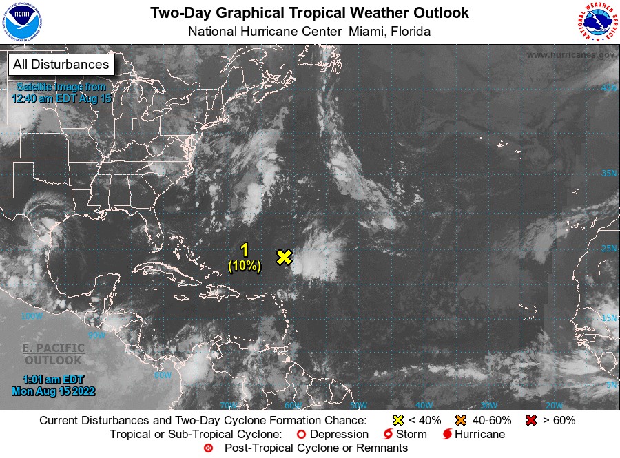
AREA OF SPECIAL INTEREST: 10 – 20 °N AND 45 – 65 °W
Central Atlantic Ocean:
A broad trough of low pressure continues to produce a large area of disorganised showers and thunderstorms over the central Atlantic several hundred miles south-southeast of Bermuda. Development, if any, of this system should be slow to occur due to generally unfavourable environmental conditions while the disturbance moves slowly north-northwestward or northward during the next few days. This system poses no threat to the state of Grenada.
- Formation chance through 48 hours…low…10 percent.
- Formation chance through 5 days…low…10 percent.
An eastern Caribbean tropical wave has an axis-oriented NNE-SSW from 21°N 63.5°W to St Croix to Caracas, Venezuela to 07°N 68°W. The tropical wave which is now located about 194 miles west of Grenada, is moving W at around 15 kt. This tropical wave shows up as a trough at the surface. Scattered moderate convection is noted south of 12.5°N between 65°W-67°W, and from 18°N-19°N between 59.5°W-62.5°W.
The Meteorological Service will continue to monitor the progress of these systems.
Elsewhere, tropical cyclone formation is not expected during the next 2 days.
The next update will be issued at 8 am.
Gerard Tamar, Duty Forecaster