


The Grenada Meteorological Service is currently monitoring an easterly moving cold front.
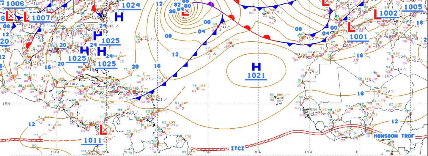
Synopsis: A cold front is over the NE Caribbean and extends through the central Leeward Islands to near 16°N 68°W. Seas of 8 feet are just N of the Leeward Islands based on altimeter data. Recent satellite-derived wind data indicate moderate to fresh N winds in the wake of the front across the waters S of Puerto Rico. Winds increase to fresh to strong speeds S of Dominican Republic to about 14°N. Seas are 7 to 8 feet within these winds for the forecast, the aforementioned cold front will move SE and dissipate through tonight. Large northerly swell will impact Atlantic passages of the NE Caribbean today then gradually become NE over the weekend before subsiding Mon. High pressure will prevail across the western Atlantic and move slowly E-SE through Monday.
Forecast for the State of Grenada: Satellite observations and model data indicate that the cold front should continue on its current path resulting in moderate seas conditions and NE’ly- E’ly swells. Hazy and windy conditions will continue with the possibility of isolated showers.
Potential impacts:
- Be prepared for isolated cases of erosion in exposed areas as well as sheltered areas
- Be prepared to secure small crafts and larger ones irrespective of tide phase Mariners should take caution due to reduced visibility, especially during dense haze
- Cruise Terminal Berths may be unusable for all ships when significant wave height is above 6.5 feet (2 m)
Next update will be issued if conditions worsen or as necessary.
Andre Charles
Duty Forecaster