


For Tropical North Atlantic Ocean, Caribbean Sea and Gulf of Mexico
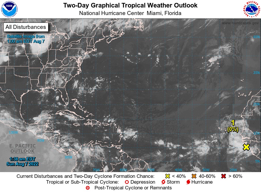
AREA OF SPECIAL INTEREST: 10 – 20 °N AND 45 – 65 °W
Tropical Wave # 1:
A tropical wave has just crossed into the Caribbean, extending along 62°W from 05°N to 21°N, 20 nautical miles west of Grenada, moving W at 20 kt. Scattered moderate convection is observed behind the wave from 12°N to 16°N, between 55°W and 61°W. This convection will bring periods of heavy rainfall and gusty winds to the central Lesser Antilles overnight and through the morning.
Models suggest this wave will continue to induce showery activity with a low chance of lightning and thunder over the northern section of the state. Additionally, model guidance suggests that a shear line with a band of moisture and instability trailing this wave, has the potential to support similar conditions on Monday.
Tropical Wave #2:
A tropical wave located near the west coast of Africa is producing disorganized showers and thunderstorms over the far eastern tropical Atlantic. Environmental conditions are expected to be conducive for gradual development of this system while it moves westward to west-northwestward at 15 to 20 mph across the eastern and central tropical Atlantic, and a tropical depression could form around the middle part of week. There is a low (near 0%) chance of tropical cyclone formation during the next 2 days and a medium (40%) chance within the next 5 days.
The Meteorological Service will continue to monitor the progress of these waves and provide updates in a timely manner.
Elsewhere, tropical cyclone formation is not expected during the next 2 days.
The next update will be issued at 8 am.
Johnathan Pryce, Duty Forecaster