


For Tropical North Atlantic Ocean, Caribbean Sea, and Gulf of Mexico
Area Of Special Interest: 10–20°N and 40–65°W
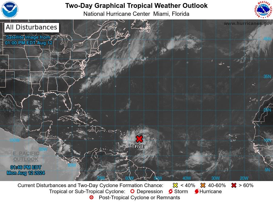
Potential Tropical Cyclone Five: The disturbance was centered near latitude 15.5 °North, longitude 56.4 °West. The system is moving toward the west near 26 mph. A westward to west-northwestward motion with some decrease in forward speed is expected during the next couple of days. On the forecast track, the disturbance is expected to move across portions of the Leeward Islands late tonight or Tuesday and approach the US and British Virgin Islands and Puerto Rico Tuesday evening. Then, the disturbance is forecast to move away from Puerto Rico over the western Atlantic through midweek. Maximum sustained winds are near 35 mph with higher gusts. Gradual strengthening is forecast during the next couple of days, and the disturbance is expected to become a tropical depression later today or tonight and become a tropical storm as it nears the Leeward Islands. This system has a high chance, near 100%, of becoming a tropical cyclone within the next 48 hours.
Model guidance indicates an increase in cloudiness, accompanied by light to moderate showers and thunderstorms from tonight, for the state of Grenada because of Potential Tropical Cyclone Five.
The next update will be issued at 8 pm.
Meteorological Services, MBIA
Grenada Airports Authority (GAA)