


For Tropical North Atlantic Ocean, Caribbean Sea and Gulf of Mexico
AREA OF SPECIAL INTEREST: 10 – 20 °N AND 45 – 65 °W
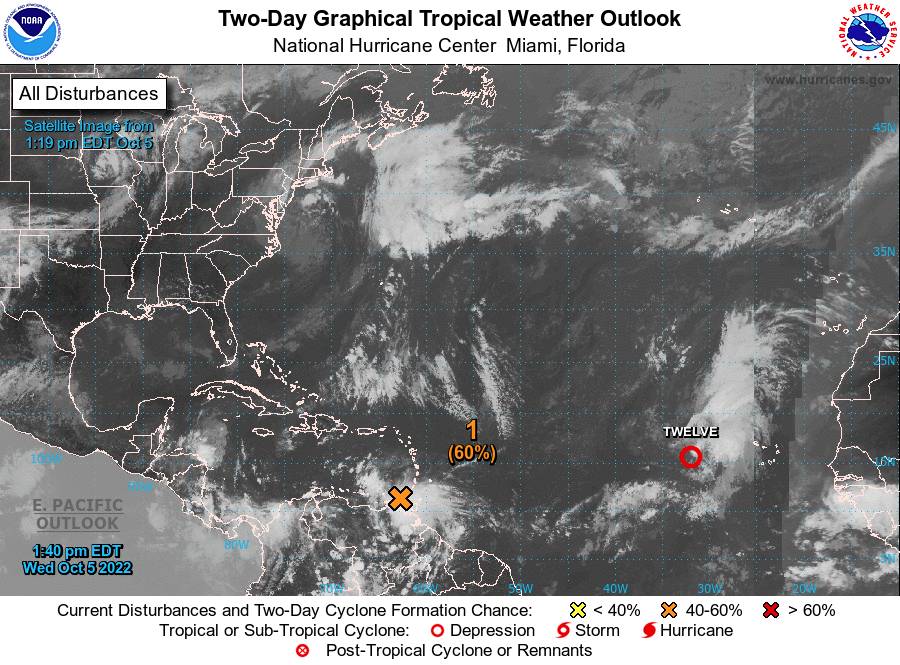
Disturbance #1 (orange X):Surface observations and data from an Air Force Reserve reconnaissance aircraft mission this morning indicate that the broad area of low pressure located over the far southeastern Caribbean Sea does not have a well-defined centre. Although the system is producing a large area of showers and thunderstorms over the southern Windward Islands and adjacent waters, satellite and radar imagery from Barbados show that it is not well organised. The system is forecast to move westward near the northern coast of South America, and interaction with land is likely to hinder significant development during the next day or so. After that time, environmental conditions are expected to become more conducive for development, and a tropical depression is likely to form within the next 2 to 3 days when the system is over the south-central Caribbean Sea. Regardless of development, heavy rainfall with localised flooding, as well as gusty winds to gale force, are expected over portions of the Windward Islands, northern portions of South America, and the ABC Islands during the next day or two. Formation chance through 48 hours, medium, 60 %. Formation chance through 5 days, high, 80%.
While more significant showers and thunderstorm activities are concentrated southeast of Grenada affecting Trinidad and Tobago, northern Guyana and Venezuela, the tail end of the wave is expected to support partly cloudy to overcast conditions, gusty winds with light to moderate showers, some of which may become heavy and a low chance of thunderstorms across the State of Grenada.
The Meteorological Office has issued warnings for the following:
- Street flooding
- Low chance of flash flooding and landslides in vulnerable areas
- A marine warning remains in effect due to agitated seas extending to 9 feet in NE’ly to E’ly swells
The Meteorological Service will continue to monitor the progress of these systems and provide updates in a timely manner.
Elsewhere, tropical cyclone formation is not expected. The next update will be issued at 8 pm.
Eugine Whint, Duty Forecaster