


FOR TROPICAL NORTH ATLANTIC OCEAN, CARIBBEAN SEA, AND GULF OF MEXICO AREA OF SPECIAL INTEREST: 10–20°N AND 45–65°W

Tropical wave 1: A central Atlantic tropical wave has its axis along 49°W, about 735 nautical miles east of Grenada. It is moving westward at 5 to 10 knots. Widely scattered moderate convection is seen from 04°N to 11°N between 40°W and 50°W. Model guidance indicates a potential for increased instability and cloudiness on Saturday well ahead of the wave’s axis.
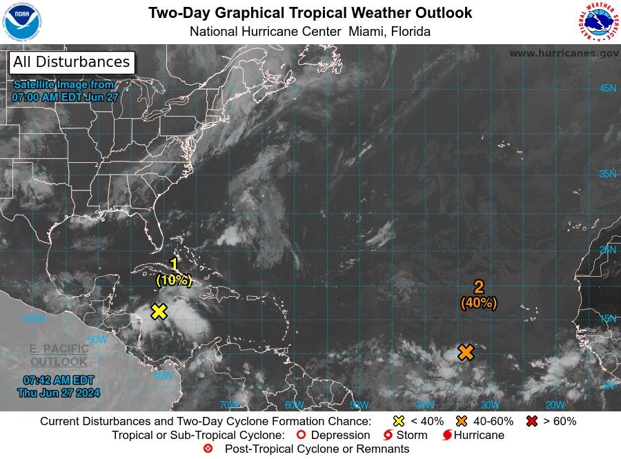
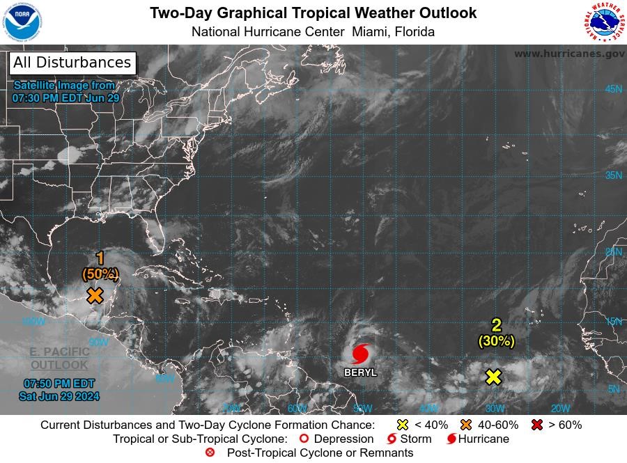
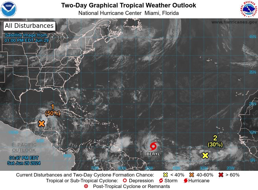
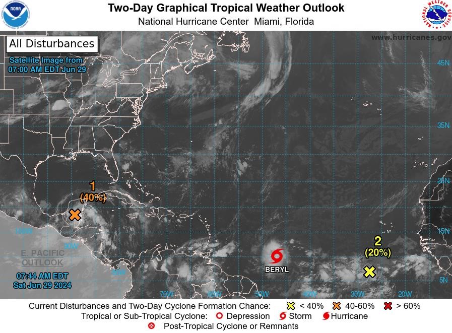
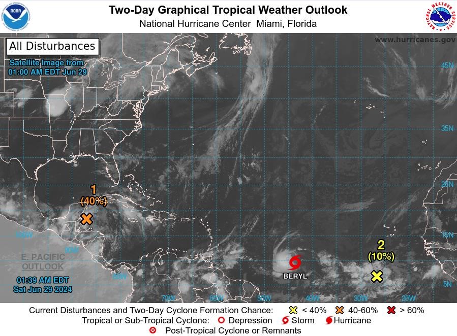
Disturbance 1: A tropical wave over the western Caribbean Sea is producing widespread but disorganised showers and thunderstorm activity while it moves westward at around 20 mph. Some development of this system is possible over the northwestern Caribbean Sea or over the southwestern Gulf of Mexico during the next several days. This system has a low chance, 10%, of becoming a tropical cyclone in the next 48 hours.
Disturbance 2: A tropical wave located several hundred miles west-southwest of the Cabo Verde Islands continues to produce disorganised showers and thunderstorm activity. Environmental conditions are forecast to be conducive, and development of this system is anticipated. A tropical depression or tropical storm is likely to form this weekend several hundred miles east of the Windward Islands while the system moves westward at 15 to 20 mph. This system has a medium chance, 40%, of becoming a tropical cyclone in the next 48 hours.
The next update will be issued at 2 pm.
Fimber Frank
Duty Forecaster