


FOR TROPICAL NORTH ATLANTIC OCEAN, CARIBBEAN SEA, AND GULF OF MEXICO AREA OF SPECIAL INTEREST: 10–20°N AND 45–65°W

Tropical wave: A tropical wave is moving across the Lesser Antilles with axis along 61°W/62°W from 19°N southward into northeast Venezuela, moving west at 10 to 15 kt. Clusters of moderate to isolated strong convection are noted mainly on the east side of the wave axis from 08°N to 13°N between 57°W and 63°W. Model guidance indicates instability, cloudiness, and shower activity will continue throughout most of today. The Met Office continues to monitor this system.
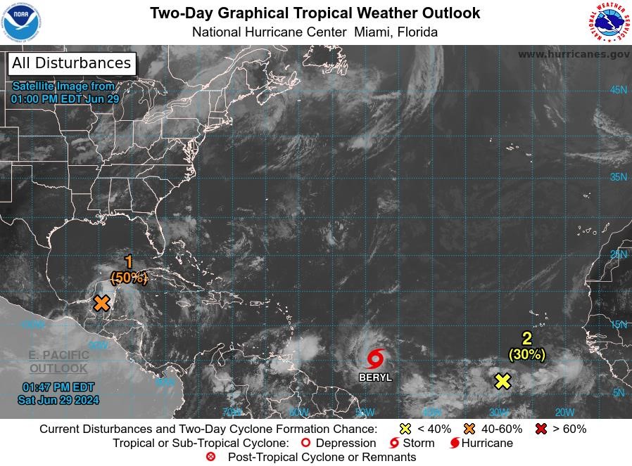
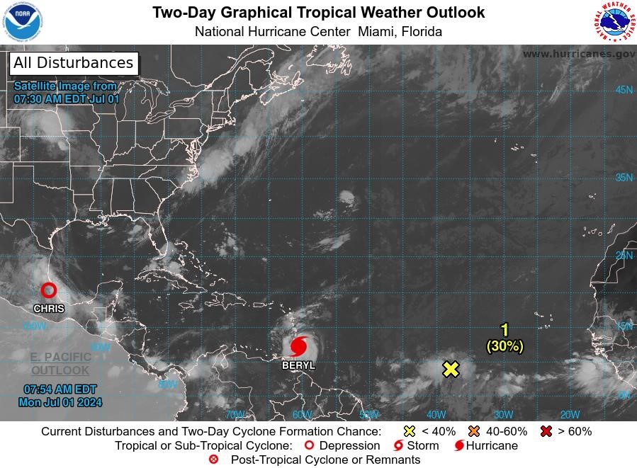
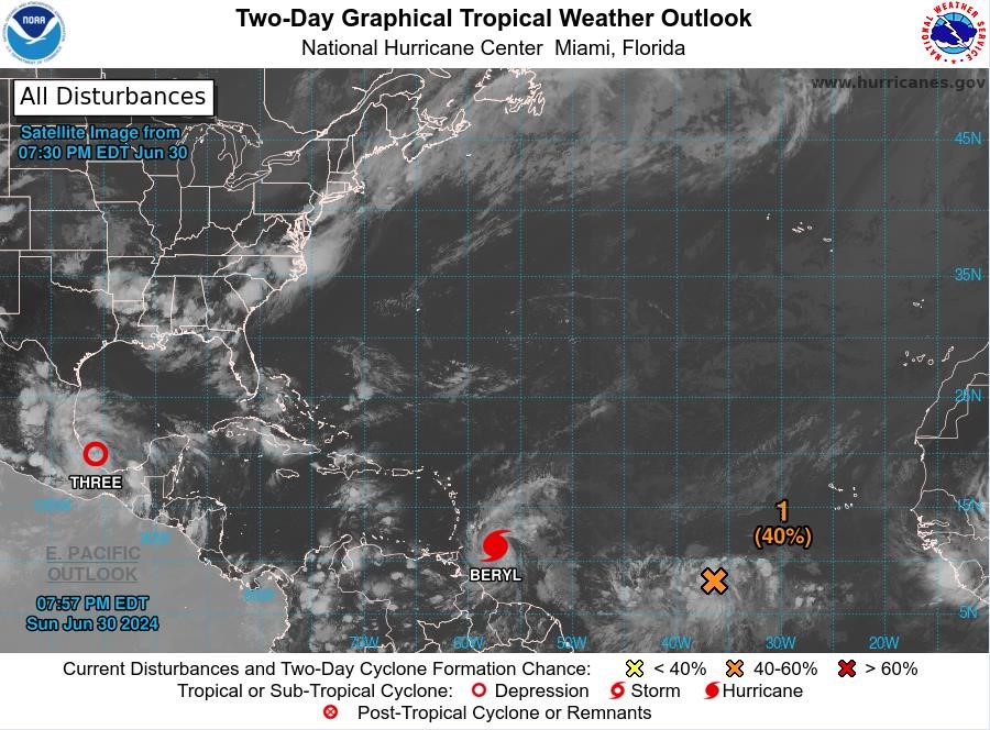
Tropical Storm Beryl: At 2 pm, the centre of Tropical Storm Beryl was located near latitude 10.0° North, longitude 48.4° West. Beryl is moving toward the west near 23 mph. A relatively quick westward to west-northwestward motion is expected during the next few days. On the forecast track, the system is expected to move across the Windward Islands late Sunday night and Monday. Maximum sustained winds are near 65 mph with higher gusts. Rapid strengthening is forecast, and Beryl is expected to become a major hurricane before it reaches the Windward Islands. Tropical-storm-force winds extend outward up to 45 miles from the centre. The estimated minimum central pressure is 998 mb.
A Hurricane Watch is in effect for Grenada, Carriacou and Petite Martinique. The Met Office continues to monitor this system.
Disturbance 1: A broad area of low pressure is forecast to form over the Bay of Campeche tonight or early Sunday, where conditions appear generally conducive for further development. A tropical depression could form before the system moves inland again early next week over Mexico. Interests along the Gulf coast of Mexico should monitor the progress of this system. Regardless of development, heavy rainfall associated with the area of low pressure will affect portions of Central America and Mexico through early next week. This system has a medium chance, 50%, of becoming a tropical cyclone within the next 48 hours.
Disturbance 2: An area of low pressure located several hundred miles southwest of the Cabo Verde Islands is producing an area of disorganised showers and thunderstorms. Environmental conditions appear conducive for additional development of this system, and a tropical depression could form by the middle of next week while it moves generally westward at 15 to 20 mph across the eastern and central tropical Atlantic. This system has a low chance, 30%, of becoming a tropical cyclone within the next 48 hours.
The next update will be issued at 8 pm.
Meteorological Department
Grenada Airports Authority