


FOR TROPICAL NORTH ATLANTIC OCEAN, CARIBBEAN SEA, AND GULF OF MEXICO AREA OF SPECIAL INTEREST: 10–20°N AND 45–65°W

Tropical wave: A western Atlantic tropical wave is near 56°W, about 320 nautical miles east of Grenada, extending southward from 18°N. This wave is moving west at 5-10 knots. Scattered moderate convection is present from 09°N to 14°N between 53°W and 59°W. Model guidance indicates a potential for increased instability, cloudiness, and shower activity on Saturday ahead of this wave’s axis. The Met Office continues to monitor this system.
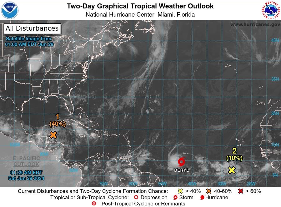
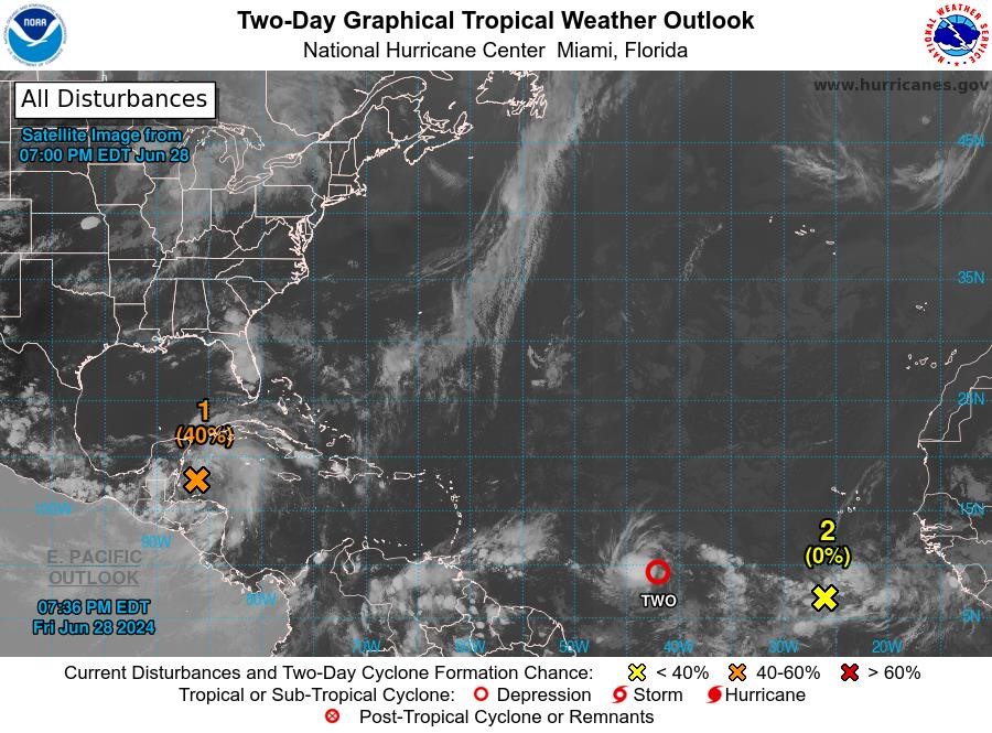
Disturbance 1: A broad area of low pressure over the northwestern Caribbean Sea continues to produce widespread but disorganised showers and thunderstorm activity. Development of this low is not anticipated before it moves inland over the Yucatan Peninsula on Saturday. The system is then forecast to move west-northwestward, emerging over the Bay of Campeche Saturday night or early Sunday, where conditions appear generally conducive for further development. A tropical depression could form before the system moves inland again early next week over Mexico. This system has a medium chance, 40%, of becoming a tropical cyclone within the next 48 hours.
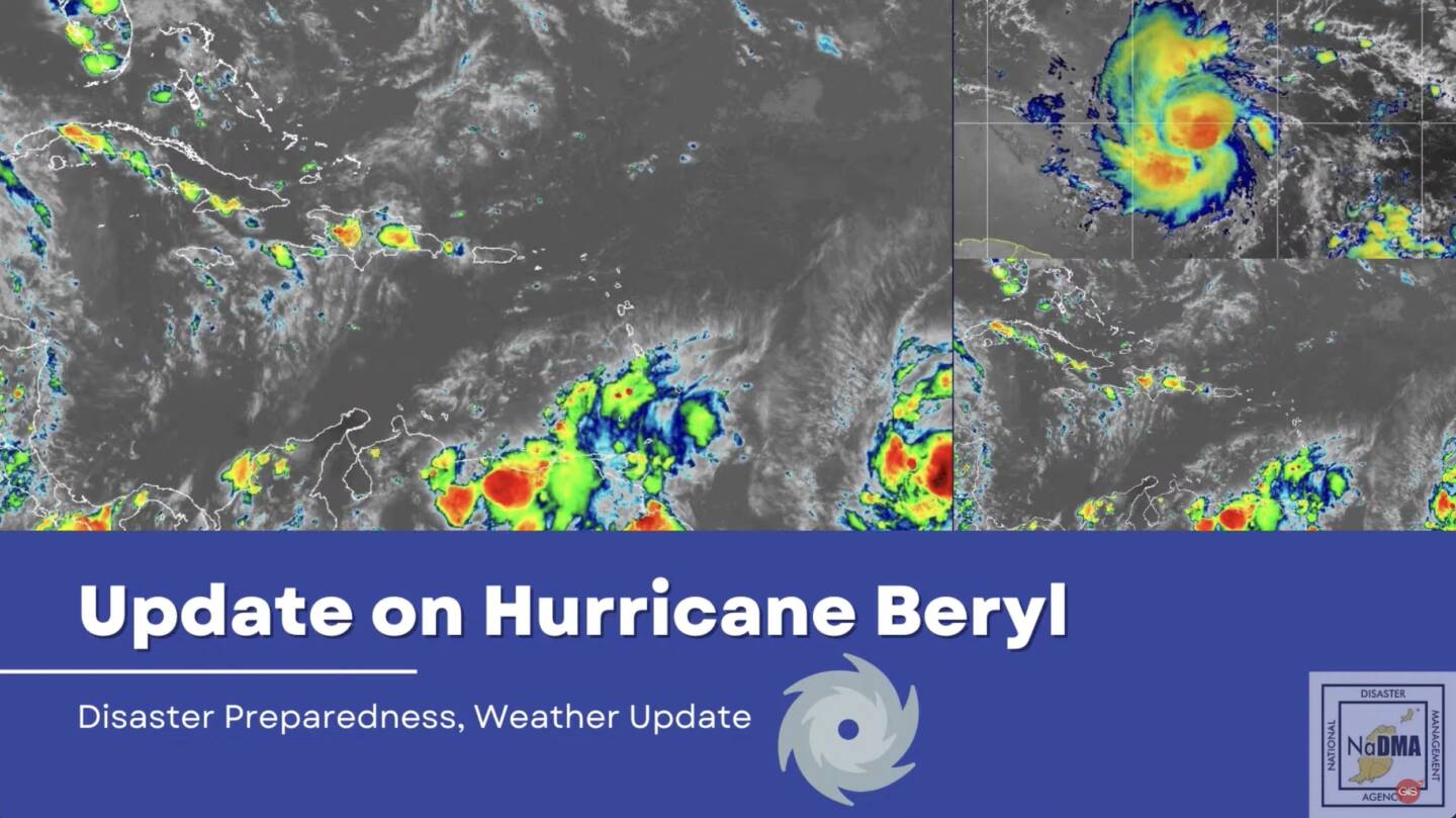
Tropical Depression 2: At 5 pm, the centre of Tropical Depression 2 was located near latitude 9.1 °North, longitude 41.9 °West. The depression is moving toward the west near 17 mph. A relatively quick westward to west-northwestward motion is expected during the next few days. On the forecast track, the system is expected to move across the Windward Islands late Sunday night and Monday. Maximum sustained winds are near 35 mph with higher gusts. Steady strengthening is forecast, and the depression is expected to become a tropical storm tonight or early Saturday and a hurricane in a couple of days. The Met Office continues to monitor this system.
Disturbance 2: A tropical wave located several hundred miles south-southwest of the Cabo Verde Islands is producing an area of disorganized showers and thunderstorms. Environmental conditions appear generally conducive for additional development of this system, and a tropical depression could form by the middle of next week while it moves generally westward at 15 to 20 mph across the eastern and central tropical Atlantic. This system has a low chance, near 0%, of becoming a tropical cyclone within the next 48 hours.
The next update will be issued at 2 am.
Fimber Frank
Duty Forecaster