


FOR TROPICAL NORTH ATLANTIC OCEAN, CARIBBEAN SEA, AND GULF OF MEXICO AREA OF SPECIAL INTEREST: 10–20°N AND 45–65°W

Tropical wave 1: Another tropical wave is in the central Atlantic, extending from 04°N to 19°N with an axis near 52°W, approximately 569 nautical miles east of Grenada, moving west at 10 to 15 kt. No significant convection is depicted at this time in association with this wave. Model guidance indicates a potential for increased instability and cloudiness on Saturday.
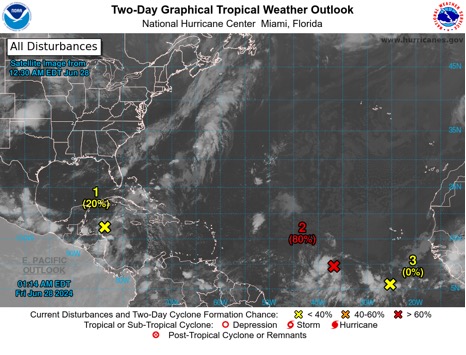
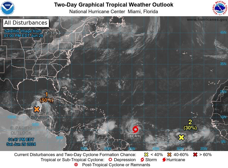
Disturbance 1: A broad area of low pressure over the western Caribbean Sea is producing widespread but disorganised showers and thunderstorm activity while it moves west-northwestward at around 15 mph. Some development of this system is possible over the northwestern Caribbean Sea or over the southwestern Gulf of Mexico during the next few days. Formation chance through 48 hours…low…20%. Formation chance through 7 days…low…30%.
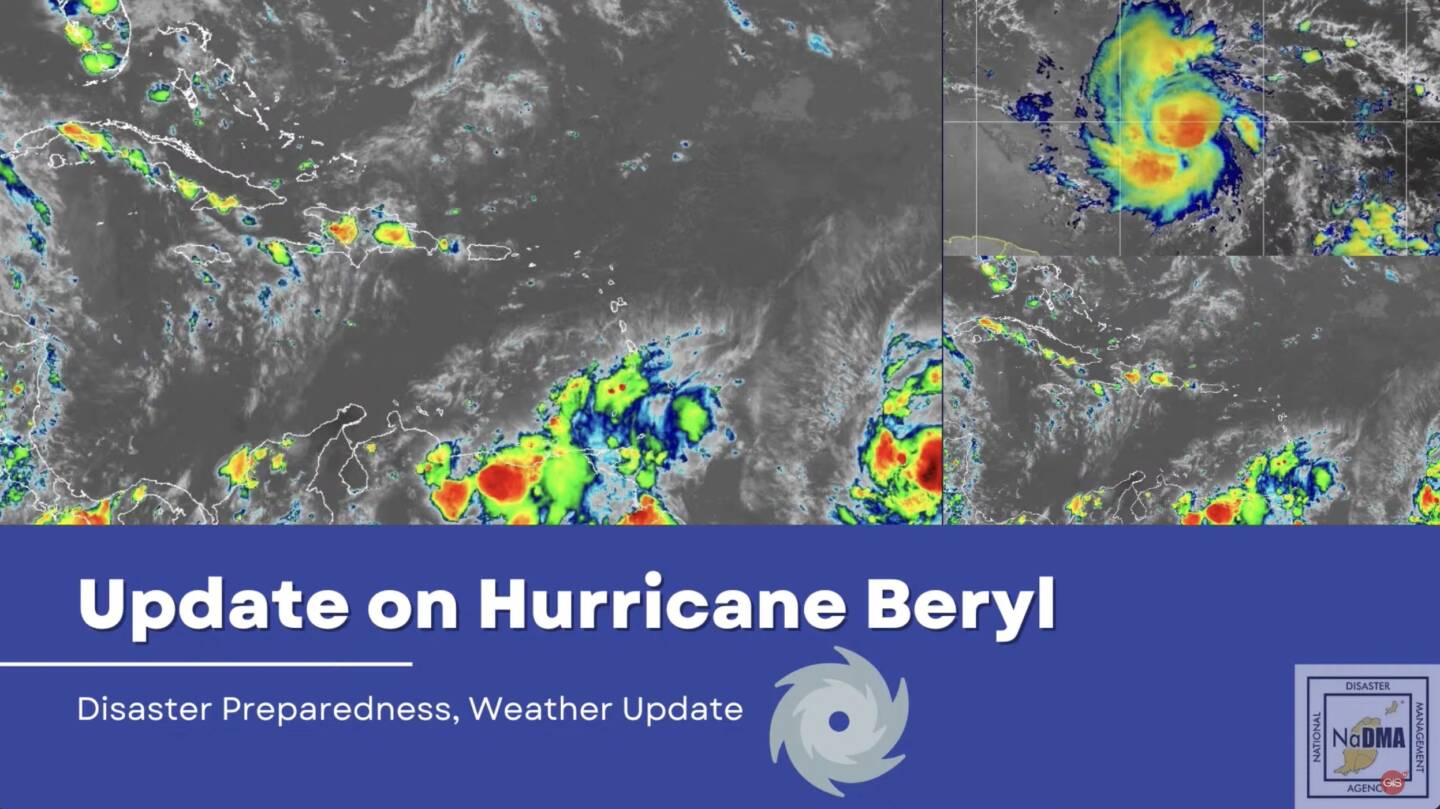
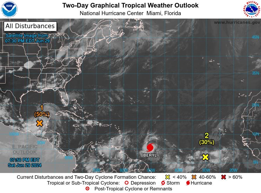
Disturbance 2: Showers and thunderstorms continue to show signs of organisation in association with a tropical wave located several hundred miles west-southwest of the Cabo Verde Islands. Environmental conditions appear conducive for additional development, and a tropical depression or tropical storm is likely to form over the next day or two. This system is expected to move westward at 15 to 20 mph towards the Windward Islands. Interests in the Lesser Antilles should monitor the progress of this system. Formation chance through 48 hours…high…80%. Formation chance through 7 days…high…90%.
Disturbance 3: A tropical wave centred a few hundred miles south-southwest of the Cabo Verde Islands is producing disorganised showers and thunderstorms. Some slow development of this system is possible early next week while it moves generally westward across the central and western tropical Atlantic at 15 to 20 mph. Formation chance through 48 hours…low…near 0%. Formation chance through 7 days…low…20%.
The next update will be issued at 8 am.
Andre Charles
Duty Forecaster