


St George’s, Grenada. Sunday, 30 June 2024, 3 pm.

Grenada, Carriacou, and Petite Martinique are currently under a Hurricane Warning.

The State of Grenada remains under a Hurricane Warning.
A Hurricane Warning means that hurricane conditions are expected within the warning area during the next 36 hours.
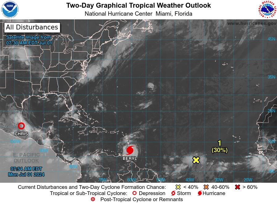
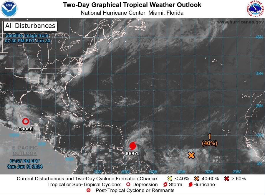
At 2 pm, the centre of Hurricane Beryl was located near latitude 10.9 °North, longitude 55.6 °West, about 351 nautical miles east southeast of Grenada. Beryl is moving toward the west near 21 mph (33 km/h). Continued quick westward to west-northwestward motion is expected during the next few days.


On the forecast track, the centre of Beryl is expected to move across the Windward Islands early on Monday and across the southeastern Caribbean Sea on Monday night and Tuesday.
Maximum sustained winds have increased to near 130 mph with higher gusts. Rapid strengthening is forecast over the next day or so, and Beryl is expected to become an extremely dangerous hurricane before it reaches the Windward Islands.
Hurricane-force winds extend outward up to 30 miles (45 km) from the centre, and tropical-storm-force winds extend outward up to 115 miles (185 km). The estimated minimum central pressure is 964 mb (28.47 inches).
Potential Impacts
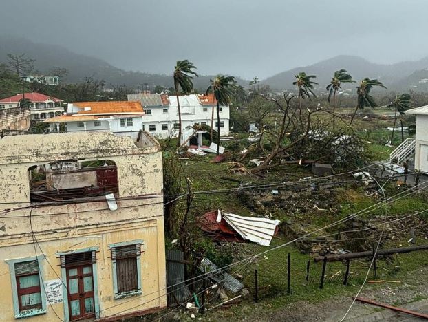
Wind: Devastating wind damage is expected (early on Monday) when the eyewall of Beryl moves through the Windward Islands.
Seas: A life-threatening storm surge with water levels 6 to 9 feet above normal tide levels in areas where Beryl makes landfall.
Rainfall: Rainfall totals of 75 to 150 millimetres across Barbados and the Windward Islands Sunday night into Monday. This rainfall may cause flooding in vulnerable areas.
Surf: Swells generated by Beryl are expected to reach the Windward and southern Leeward Islands by this evening.
The Met Office and NaDMA continue to monitor Hurricane Beryl.
The following are some preparedness actions that you should take:
- Update your family disaster plan
- Have a Disaster supplies kit (3-day supply of non-perishable food, water, medication, flashlights, etc.)
- Trim overhanging trees and branches
- Clear guttering and drains.
- Know where the nearest Emergency Shelters are located
The public is encouraged to follow the advisories and forecasts issued by the Meteorological Office and NaDMA.
For additional information, contact Ruth Jacob-Roberts, Public Information Officer at NaDMA 440-8390-4: cell 533-0766, or email: [email protected] and [email protected].
NaDMA is the official source for all disaster-related information in Grenada.


NOAA 5pm Update: additional strengthening is forecast overnight through monday Morning:
INIT 30/2100Z 11.1N 56.5W 115 KT 130 MPH
12H 01/0600Z 11.7N 59.1W 125 KT 145 MPH <——