


FOR TROPICAL NORTH ATLANTIC OCEAN, CARIBBEAN SEA, AND GULF OF MEXICO AREA OF SPECIAL INTEREST: 10–20°N AND 45–65°W

Tropical Wave: A western Atlantic tropical wave has its axis near 49°W, approximately 745 nautical miles east of Grenada, from 03°N to 16°N. It is moving westward at 10 to 15 kt. Isolated small showers and thunderstorms are near this wave. This wave is expected to bring an increase in cloud cover, showers and thunderstorms to Grenada, Thursday into Friday; however, showery activities associated with the Intertropical Convergence Zone (ITCZ) can impact Grenada as early as today and the following days after the wave has passed.

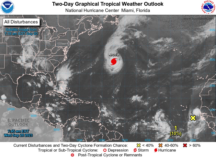
Hurricane Nigel: At 5 am, the center of Hurricane Nigel was located near latitude 34.4°N, longitude 54.9 West. Nigel is moving toward the north near 16 mph. A turn toward the northeast with an increase in forward speed is expected later today. Maximum sustained winds are near 100 mph with higher gusts. Nigel has likely reached its peak intensity, with gradual weakening expected later today, followed by faster rate of weakening on Friday. Nigel is forecast to become a post-tropical cyclone by Friday. Hurricane-force winds extend outward up to 60 miles from the center, and tropical storm-force winds extend outward up to 160 miles.

The estimated minimum central pressure is 971 mb. This system currently poses no direct threat to the state of Grenada.
Eastern Tropical Atlantic: A tropical wave is currently located just off the west coast of Africa. Environmental conditions are forecast to be conducive for gradual development, and a tropical depression is likely to form late this week or this weekend while the system moves generally westward at 10 to 15 mph across the eastern and central tropical Atlantic. This system has a low, 10%, chance of development within the next 2 days and a high, 70%, chance of development within the next 7 days. This system poses no direct threat to the state of Grenada.


The Meteorological Service will continue to monitor these systems and provide updates in a timely manner.
The next update will be issued at 2 pm.
Trisha Miller, Duty Forecaster