


Tropical weather outlook (courtesy: NHC)
Meteorological services, MBIA

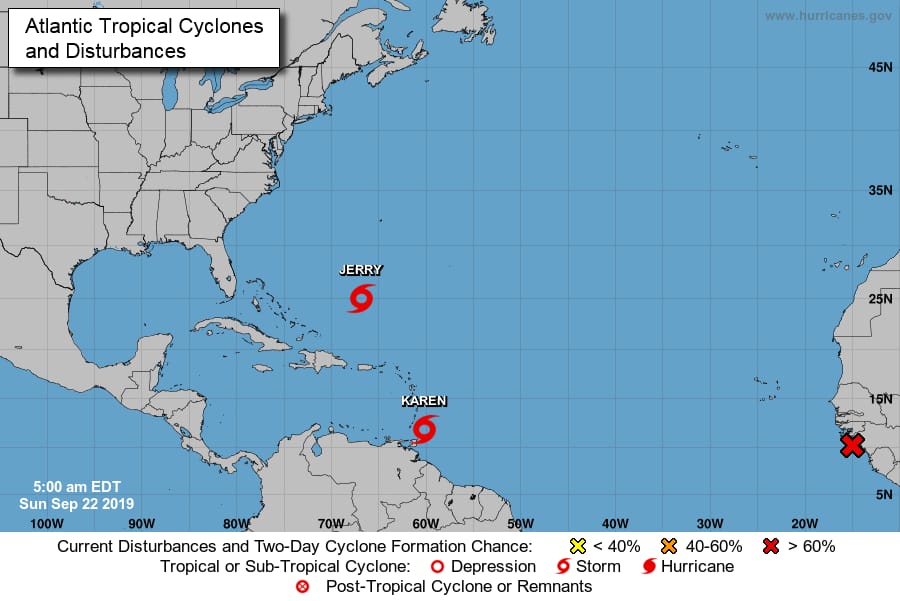
Area of special interest: 10°–20 °N and 45°–65°W
At 8 am LST (Local Standard Time), the centre of Tropical Storm Karen was located near latitude 11.9° North, longitude 60.9° West. It is 55 miles east-southeast of Grenada.
Karen is moving toward the west-northwest near 9 mph and this general motion is expected to continue today. A turn toward the northwest is forecast to occur on Monday, followed by a turn toward the north on Tuesday. On the forecast track, Karen will move across the Windward Islands today, and emerge over the southeastern Caribbean Sea tonight. Maximum sustained winds are near 40 mph with higher gusts. Little change in strength is forecast during the next 48 hours. Tropical-storm-force winds extend outward up to 125 miles from the centre. The estimated minimum central pressure is 1005 mb.
Grenada and its dependencies are under a tropical storm warning and tropical storm conditions are expected to start affecting the tri-island within the next 3 hours.
The centre of Karen is expected to cross Grenada by 2 pm LST. A flood and landslide warning is in effect for the tri-island state along with a high surf advisory.
Andre Charles, Forecaster


Praying that all will be well.