


28 September 2016
Issuance Time: 12:00 pm
SEVERE WEATHER BULLETIN FOR THE STATE OF GRENADA
TROPICAL STORM MATTHEW FORMS IN THE WINDWARD ISLANDS.
SUMMARY OF 1100 AM AST…1500 UTC…INFORMATION
———————————————–
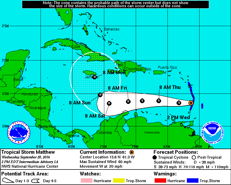
LOCATION…13.4N 60.7W
ABOUT 35 MI…55 KM SE OF ST. LUCIA
ABOUT 35 MI…55 KM ENE OF ST. VINCENT
MAXIMUM SUSTAINED WINDS…60 MPH…95 KM/H
PRESENT MOVEMENT…W OR 275 DEGREES AT 21 MPH…33 KM/H
MINIMUM CENTRAL PRESSURE…1008 MB…29.77 INCHES
A westward motion with some decrease in forward speed is expected during the next couple of days. On the forecast track, the center of Matthew will move through the Windward Islands during the next couple of hours, and move over the eastern Caribbean Sea through Friday.
Reports from an Air Force hurricane hunter aircraft indicate that maximum sustained winds are near 60 mph (95 km/h) with higher gusts. Gradual strengthening is forecast during the next couple of days, and Matthew could become a hurricane by Friday.
Tropical-storm-force winds extend outward up to 205 miles (335 km) primarily to the northeast of the center.
The estimated minimum central pressure is 1008 mb (29.77 inches).
WATCHES AND WARNINGS
——————–
CHANGES WITH THIS ADVISORY:
A Tropical Storm Warning is in effect for the French Islands of Guadeloupe and Martinique.
The Government of Barbados has issued a Tropical Storm Warning for Barbados, Dominica, and St Vincent and the Grenadine islands.
The Government of St Lucia has issued a Tropical Storm Warning for St Lucia.
The estimated minimum central pressure is 1008 mb (29.77 inches).
Grenada experienced cloudy to overcast conditions with showers and thundershowers overnight into this morning. Cloudy periods with moderate to heavy showers, thundershowers and squally winds are expected this afternoon and overnight as a large convective area associated with Tropical Strom Matthew continues to envelop our area.
Medium scale landslides can be expected. Sea conditions are also anticipated to become very agitated and adversely affect marine and coastline interests, with waves in extending to 13 ft in Northerly swells. As the system continues to intensify, showers can yield in excess of 30 to 60 mm of rainfall from Wednesday into Thursday. Wind gusts in excess of 35 mph (gale force) are likely. Hence, marine and gale force warnings remain in effect! Medium-scale landslides and flooding in low lying can also be expected.
We underscore that although Grenada, Carriacou and Petite Martinique have not been placed under tropical storm watch or warning, the close proximity of the island to the center of the storm and the broad area of convective clouds and thunderstorms embedded in the system will result in an imminent threat of storm force winds, moderate to heavy rainfall, landslides and flooding in low-lying areas.
The Grenada Meteorological Service continues to closely monitor the system and will issue further bulletins as the situation warrants. All interests in Grenada, Carriacou and Petite Martinique are asked to regard the possibility of these severe weather conditions seriously and adopt measures which would safeguard lives and property. We urge you to heed the information disseminated by Grenada Meteorological Service and the National Disaster Management Agency.