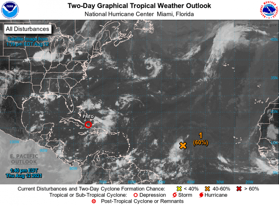


For Tropical North Atlantic Ocean, Caribbean Sea and Gulf of Mexico: Area of Special Interest: 10–20°N and 45–65°W.

Tropical Wave 1: A strong tropical wave 1336 nautical miles East of Grenada over the central Atlantic is producing disorganised showers and thunderstorms, mainly to the west of the centre. A recent scatterometer satellite pass depicts a small area of low pressure along the northern part of the wave and strong to near gale-force winds near the centre. Environmental conditions are expected to become more conducive for additional development, and a tropical depression is likely to form by the weekend while moving generally westward at about 20 mph across the tropical Atlantic. This system is expected to reach portions of the Leeward Islands late Saturday or early Sunday, and interests there should monitor its progress.
Tropical Wave 2: An Atlantic tropical wave has its axis 577 nautical miles East of Grenada, along 56°W, south of 20°N and it is moving West at 15-20 knots. Recent scatterometer satellite data and visible imagery show a broad surface curvature associated with this wave. Fresh to locally strong NE winds is noted from 17°N to 22°N and between 51°W and 57°W. Scattered showers are noted where the wave interacts with the ITCZ from 08°N to 10°N between 54°W and 56°W.
The Meteorological Service will continue to monitor this wave.
Elsewhere, tropical cyclone formation is not expected during the next 2 days.
The next update will be issued at 8 pm.
Andre Charles, Duty Forecaster