


For Tropical North Atlantic Ocean, Caribbean Sea, and Gulf of Mexico
Area Of Special Interest: 10–20°N and 40–65°W

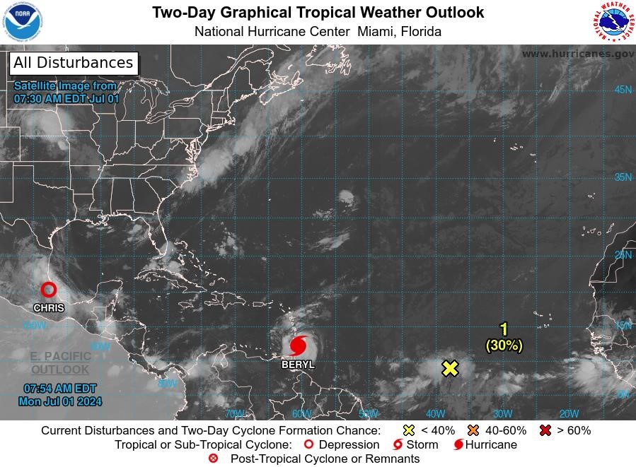
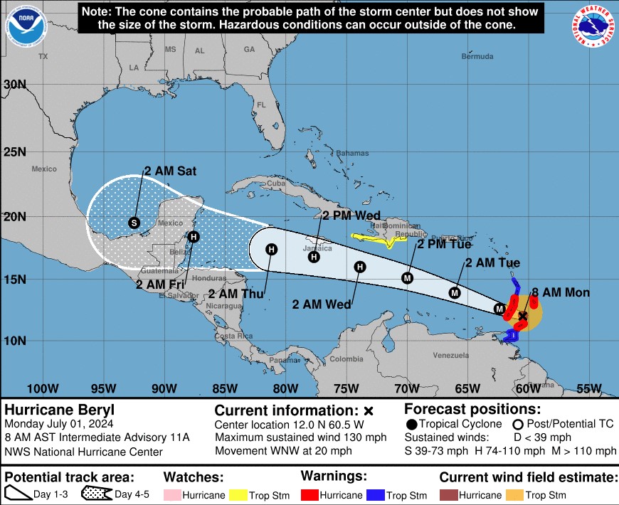
Hurricane Beryl: At 8 am, the eye of Hurricane Beryl was located near latitude 12.0° North, longitude 60.5° West, about 70 miles east of Grenada. Beryl is moving toward the west-northwest near 20 mph. A continued quick westward to west-northwestward motion is expected during the next few days. On the forecast track, the centre of Beryl is expected to move across the Windward Islands this morning and across the southeastern and central Caribbean Sea late today through Wednesday. Data from the NOAA and Air Force Hurricane Hunters indicate that maximum sustained winds have increased to near 130 mph with higher gusts. Beryl is a category 4 hurricane on the Saffir-Simpson Hurricane Wind Scale. Fluctuations in strength are likely during the next day or so, but Beryl is expected to remain an extremely dangerous major hurricane as its core moves through the Windward Islands into the eastern Caribbean. Some weakening is expected in the central Caribbean by midweek, though Beryl is forecast to remain a hurricane. Hurricane-force winds extend outward up to 35 miles from the centre, and tropical storm-force winds extend outward up to 125 miles. Grantley Adams International Airport in Barbados recently reported sustained winds of 47 mph with a gust to 69 mph. The estimated minimum central pressure based on dropsonde data is 959 mb.
A Hurricane Warning is in effect for Grenada, Carriacou and Petite Martinique. The Met Office continues to monitor Hurricane Beryl.
 Disturbance 1: Showers and thunderstorms continue in association with an area of low pressure located over 1000 miles east-southeast of the Windward Islands. Environmental conditions appear marginally conducive for additional development of this system, and a tropical depression could form by the middle part of this week while it moves generally westward at 15 to 20 mph across the central and western tropical Atlantic. Interests in the Lesser Antilles should monitor the progress of this system. This system has a medium chance, 30%, of becoming a tropical cyclone within the next 48 hours.
Tropical Depression Chris: At 8:00 am, the centre of Tropical Depression Chris was located near latitude 20.2 North, longitude 97.7 West. Chris is moving toward the west near 12 mph, and this motion will continue until the system dissipates. Maximum sustained winds are near 35 mph with higher gusts. Chris will likely dissipate over the higher terrain later this morning. The estimated minimum central pressure is 1007mb.
The next update will be issued at 2 pm.
Meteorological Services, MBIA
Grenada Airports Authority (GAA)