For Tropical North Atlantic Ocean, Caribbean Sea and Gulf of Mexico
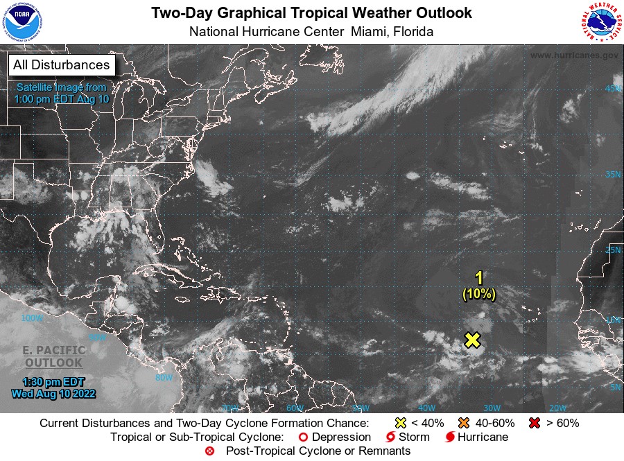
AREA OF SPECIAL INTEREST: 10–20°N AND 45–65°W
Tropical Wave # 1:
Shower and thunderstorm activity associated with a tropical wave located several hundred miles west-southwest of the Cabo Verde Islands has decreased since yesterday. This system is expected to move westward to west-northwestward at 15 to 20 mph across the tropical Atlantic during the next several days, and significant development is becoming less likely. This wave has a low chance, 10%, of becoming a tropical wave within the next 48 hours.
Tropical Wave #2:
An eastern Caribbean tropical wave is near 62° West from 20° North southward across the Leeward Islands into northeastern Venezuela and moving west about 10 knots. Scattered showers and isolated thunderstorms are evident near the Islands of Trinidad and Tobago. The Intertropical Convergence Zone (ITCZ) extends eastward from the Lesser Antilles and supports a band of moisture to the east of the wave’s axis. As such, radar imagery is depicting widely scattered precipitation, some heavy, in and around the axis of the wave.
Tropical Wave #3:
A central Atlantic tropical wave is near 49° West, approximately 745 nautical miles east of Grenada. Its axis extends from 20° North southward and moving west about 10 knots. Scattered showers are noted from 10°North to 13°North between 46° West and 30° West. The ITCZ extends east and west of the axis supporting a band of moisture, clouds, and precipitation in the area.
The Meteorological Service will continue to monitor the progress of these waves and provide updates in a timely manner.
Elsewhere, tropical cyclone formation is not expected during the next 2 days.
The next update will be issued at 8 pm.
Fimber Frank, Duty Forecaster


