


For Tropical North Atlantic Ocean, Caribbean Sea and Gulf of Mexico

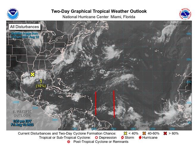
AREA OF SPECIAL INTEREST: 10 – 20 °N AND 45 – 65 °W
Tropical Wave #1
A central Atlantic tropical wave has its axis along 59°W, extending 21°N southward, 145 nm east of Grenada and is approaching Barbados. It is moving westward at 10 -15kt. Satellite imagery reveals no significant convection with the wave currently.
Based on its forward speed and model projections, the axis of this wave should traverse the island chain early Saturday morning. Weather models further suggest that the wave will interact with the Inter-Tropical Convergence Zone (ITCZ) inducing cloudiness and light to moderate showers; some of which may become heavy at times and accompanied by thunder and lightning across the State of Grenada, if environmental conditions remain favourable. Seas may become agitated in N’ly to NE’ly swells. Additionally, there is a medium chance (40% -60%) of gusty winds during showers and thunderstorms and flooding and landslides in vulnerable areas.
Tropical Wave #2
A central Atlantic has its axis along 49.5°W from 23°N southward, 702 nm east of Grenada and is moving westward at 15kt to 20 kt. Scattered moderate convection is occurring from 09°N to 13°N between 46°W and 48°W and from 09°N to 11vN between 48°W and 52°W. Based on its forward speed and model projections, the axis of this wave should traverse the island chain on Sunday. Weather models signal that the system will interact with the Inter-Tropical Convergence Zone (ITCZ) , inducing cloudiness, moderate to heavy showers and thunderstorm activity on Sunday and Monday across the State of Grenada if environmental conditions are favourable. Seas may become agitated in N’ly to NE’ly swells also. Additionally, there is a medium chance (40% -60%) of gusty winds during showers and thunderstorms and flooding and landslides in vulnerable areas.
The Meteorological Service will continue to closely monitor the progress of these waves and provide updates in a timely manner.
Elsewhere, tropical cyclone formation is not expected during the next 2 days.
The next update will be issued at 8 pm.
Cécil Mitchell, Duty Forecaster